Landscape metrics in assessing how the configuration of urban green spaces affects their cooling effect: A systematic review of empirical studies
Published in Landscape and Urban Planning, 2023
Recommended citation: Li, Y., Ren, C., Ho, J. Y., & Shi, Y. (2023). Landscape metrics in assessing how the configuration of urban green spaces affects their cooling effect: A systematic review of empirical studies. Landscape and Urban Planning, 239, 104842. https://doi.org/10.1016/j.landurbplan.2023.104842
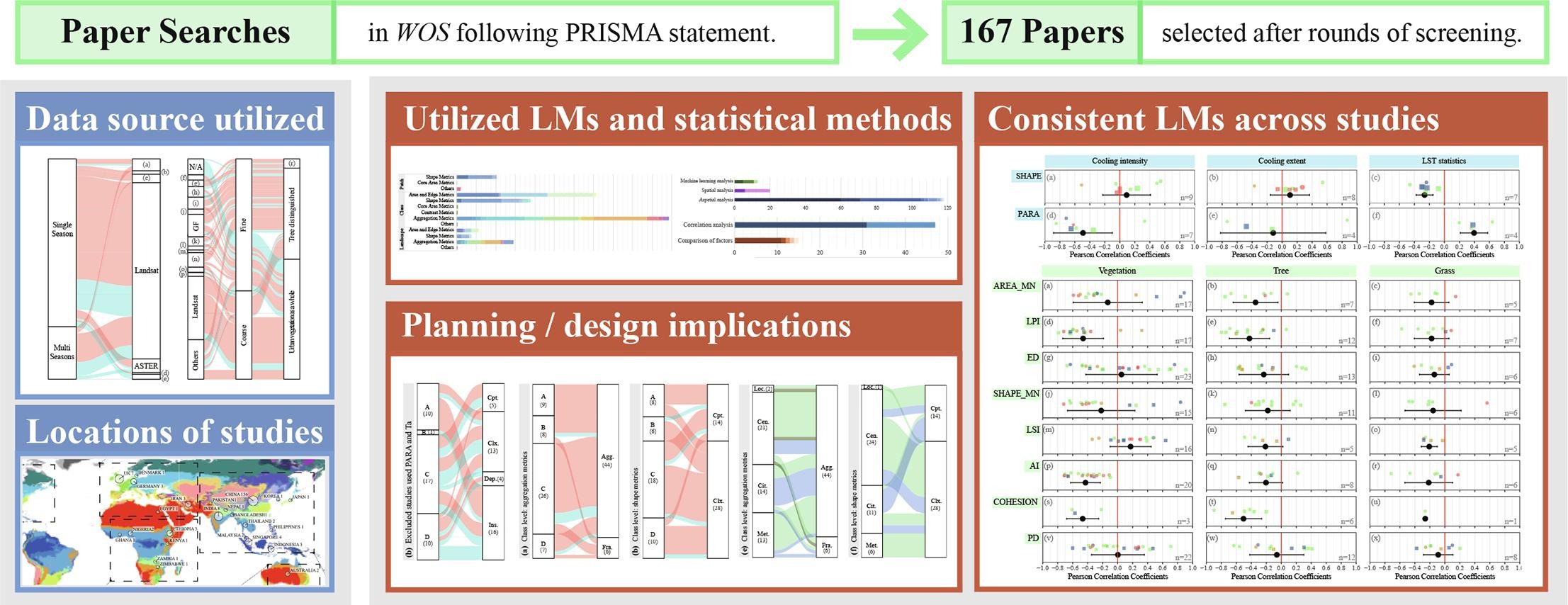
Urban green spaces (UGS) are effective mitigations to excessive urban heat. Landscape metrics (LMs) have been widely used to assess how UGS configuration, i.e., edge and area, shape complexity, and aggregation, may facilitate better cooling. However, application of configurational LMs has produced diverging suggestions for planning and design practice, which cannot provide urban and landscape designers with holistic insights for future sustainable development. Thus, we conducted a systematic review to (1) summarize the contextual and methodological factors in pertinent studies, and (2) synthesize extractable results and implications, and see if the contextual and methodological factors may help to interpret the diversity in planning and design implications. A total of 167 studies were identified, covering 90 cities in 27 countries belonging to 16 Köppen climate zones. Evolving statistical methods have been applied, including spatial, non-spatial, and non-parametric machine-learning analyses. Synthesis of correlation coefficients reveals that patch-level metric SHAPE, and class-level metrics LPI, AI and COHESION yielded generally consistent trends across studies. No consensus was obtained based on patch-level metrics, while class-level analyses suggest aggregated, patchy, larger, and complex-shaped UGS facilitate better cooling. Contextual and methodological factors cannot help interpret the diverging suggestions. Few specific planning and design implications on UGS configuration were given. Future studies are suggested to specify either a land-use or land-cover perspective to align with practical scales in planning and design practice, and to formulate specific implications beyond binary suggestions by echoing the heterogeneity of thermal environment and UGS pattern under precise planning and design contexts with practical illustration.

Graphical Abstract

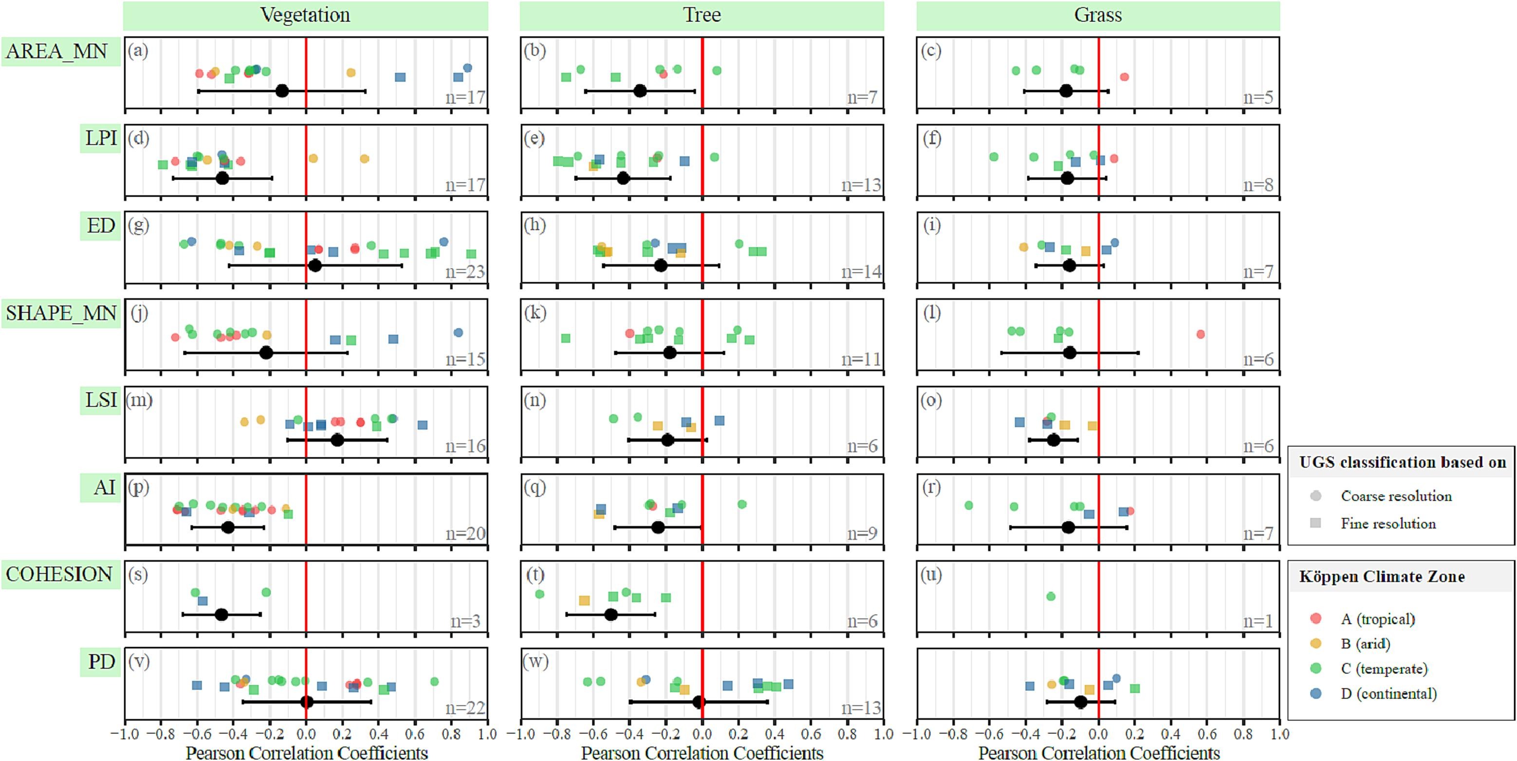
Mean and standard deviation of Pearson correlation coefficients in reviewed papers between class-level configurational LMs and mean LST. (Note: All plotted studies have used mean daytime LST as dependent variables, and have considered UGS as a type of land cover extracted from remote sensing images. n at the bottom right refers to the number of city cases included. See Appendix D for origins of the extracted data.).
